Learning Standards and Practices
7.2 COLONIAL DEVELOPMENTS: European exploration of the New World resulted in various interactions with Native Americans and in colonization. The American colonies were established for a variety of reasons and developed differently based on economic, social, and geographic factors. Colonial America had a variety of social structures under which not all people were treated equally.
(Standards: 1, 2, 3, 4; Themes: MOV, GEO, ECO, TECH, EXCH)
7.2b Different European groups had varied interactions and relationships with the Native American societies they encountered. Native American societies suffered from loss of life due to disease and conflict and loss of land due to encroachment of European settlers and differing conceptions of property and land ownership.
Ø Students will compare and contrast British interactions with southern New England Algonquians, Dutch and French interactions with the Algonquians and Iroquoians, and Spanish interactions with Muscogee.
Ø Students will investigate other Native American societies found in their locality and their interactions with European groups.
Ø Students will examine the major reasons why Native American societies declined in population and lost land to the Europeans.
A. Gathering, Interpreting and Using Evidence
5. Make inferences and draw general conclusions from evidence.
D. Geographic Reasoning
6. Describe the spatial organization of place, considering the historical, social, political, and economic implication of that organization. Describe how boundaries and definition of location are historically constructed.
Setting the Stage
Introduce students to an online map of their community like Google Maps. Hand out a map of their same community from the 1800s. Ask students to think about and discuss what would happen if everyone started using the map from the 1800s to make decisions about who could use the property in their community instead of using the modern map.
Introduce students to an online map of their community like Google Maps. Hand out a map of their same community from the 1800s. Ask students to think about and discuss what would happen if everyone started using the map from the 1800s to make decisions about who could use the property in their community instead of using the modern map.
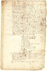
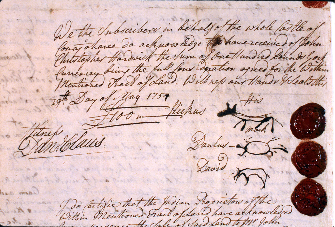
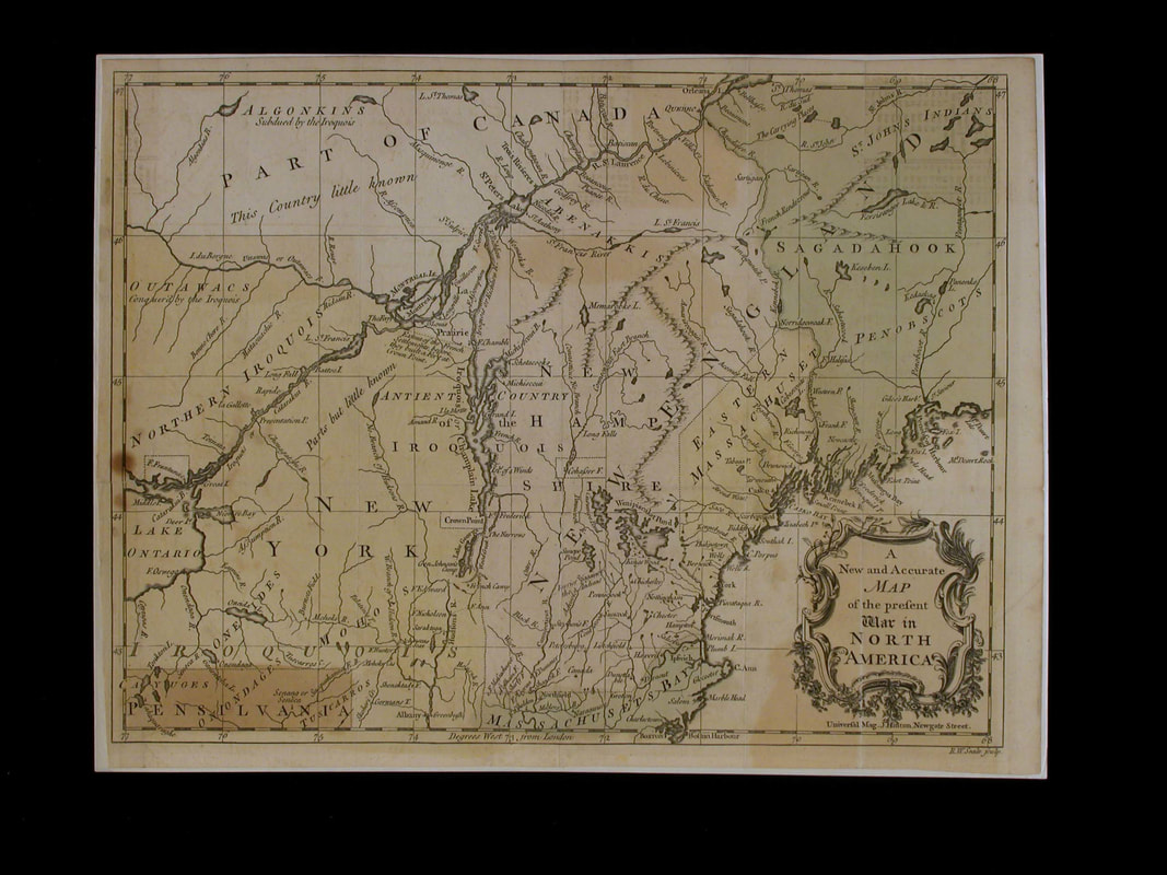
Supporting Question 1: How did the possession of land change from the time of first European contact to the American Revolution?
Formative Assessment: Using evidence from the deeds and the maps, explain the changes in Iroquoian land possession before the American Revolution.
Formative Assessment: Using evidence from the deeds and the maps, explain the changes in Iroquoian land possession before the American Revolution.

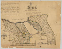
Roemer Map, 1700
Courtesy: SUNY Stony Brook |
|
Supporting Question 2: How did the possession of land change from the time of the American Revolution to the present?
Formative Assessment: Using evidence from the maps, explain the changes in Iroquoian land possession after the American Revolution.
Formative Assessment: Using evidence from the maps, explain the changes in Iroquoian land possession after the American Revolution.
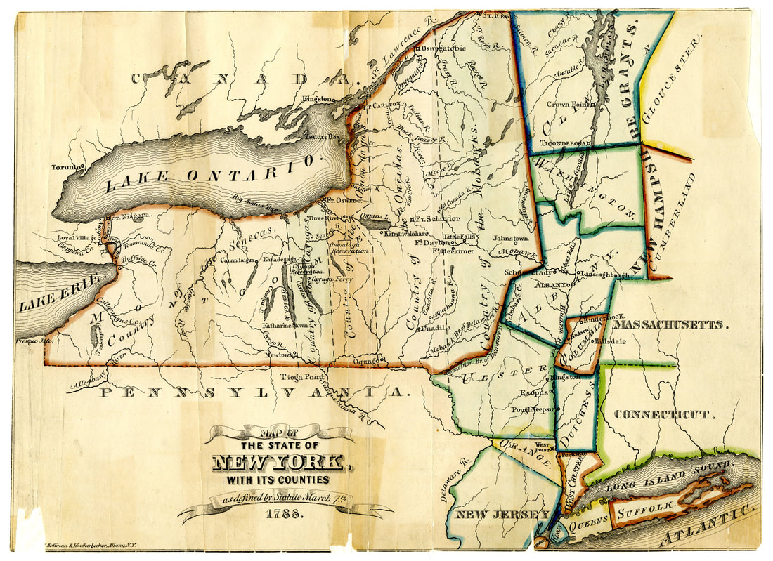
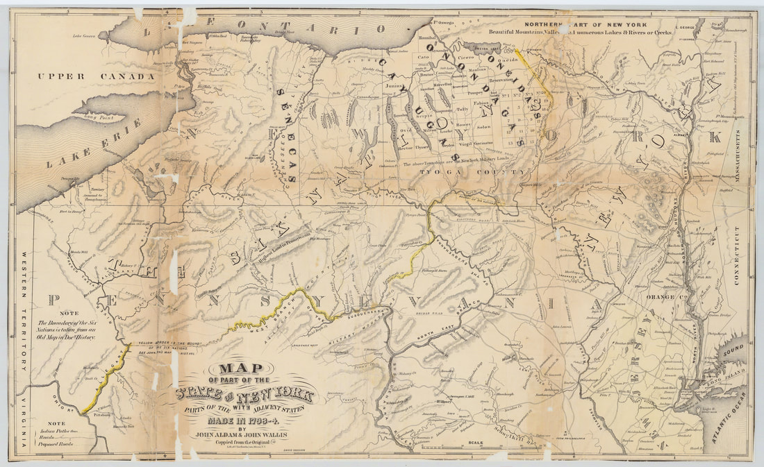
Map of the State of New York, 1788
Courtesy: New York State Archives |
|
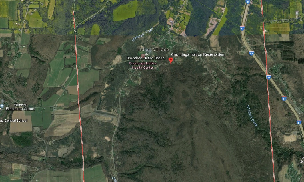
Supporting Question 3: What impact did these geographic changes have on American Indian groups in New York State?
Formative Assessment: Using evidence from the census data and maps, explain the effects of land dispossession on the Onondaga.
Formative Assessment: Using evidence from the census data and maps, explain the effects of land dispossession on the Onondaga.
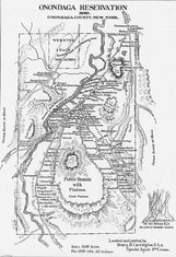
Map of the Ononodaga Reservation, 1911
Courtesy: New York State Archives |
|
Argument: What role do maps play in the social, political, and economic standing of a group or individual in society?
Extension: Research the location of American Indian groups during the American Revolution. How did their location influence their role in the war?
Taking Informed Action: Are there current issues in your community related to geography (water usage, location of schools, transportation, etc.)? If so, think of ways you could help solve one of these issues.
